Technical informations
-
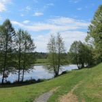
Distance 8km
-
Difficulty Very easy
-
Type of itinerary Aller simple
-
Ascent 175m
-
Negative gradient 210m
-
Daily duration 02h00
-
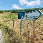
Itinéraire balisé NON_BALISE
-
Nature du terrain Not suitable for strollers
-
Altitude moyenne n/c
-
Altitude maximum 627m
Equipements
- Play area
- Picnic area
- Barbecue
- Pedestrian sports
- Hiking itinerary
services
- Restaurant
Type of clientele
- Walkers/hikers
- Level green – easy