

Technical informations
-
Distance 19km
-
Difficulty Hard
-
Type of itinerary Loop
-
Ascent 303m
-
Negative gradient 303m
-
Daily duration 01:50
-
Itinéraire balisé BALISE
-
Nature du terrain Stone, Hard coating (tar, cement, flooring), Grit
-
Altitude moyenne n/c
-
Altitude maximum 459m
Take care on the two short but fairly technical descents.
Description
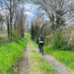
The route leaves the village of Pinay along a relatively flat stretch to Rives, before descending to the banks of the River Loire and following it to La Digue. A dam built in 1712 once stood here to regulate the river’s turbulent flow. After leaving the riverbank, the route begins a substantial climb, offering magnificent panoramic views stretching from the Matagrin Tower to the Forez mountains. The final section crosses a plateau with no major changes in elevation.
Labels
- Label VTT - FFC
Equipements
- Picnic area
- Public WC
- Car park
- Free car park
- Cycling sports
- Mountain biking itinerary
services
- Pets welcome
- Accommodation
- Restaurant
Type of clientele
- Mountain bikers
- Level red – hard