Technical informations
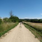
- 
                        
                        Distance 19km
- 
                        
                        Difficulty Hard
- 
                        
                        Type of itinerary Loop
- 
                        
                        Ascent 572m
- 
                        
                        Negative gradient n/c
- 
                        
                        Daily duration 06h00
- 
                        
                        Itinéraire balisé BALISE
- 
                        
                        Nature du terrain Stone, Ground, Hard coating (tar, cement, flooring)
- 
                        
                        Altitude moyenne 450m
- 
                        
                        Altitude maximum 574m
Equipements
- Pedestrian sports
- Hiking itinerary
Type of clientele
- Walkers/hikers
- Level red – hard
 
                             
                            